
.FLOODING RAINS OCCURRING ACROSS PORTIONS OF SOUTH FLORIDA...
...THE DISTURBANCE SHOULD MOVE ACROSS SOUTH FLORIDA TODAY…
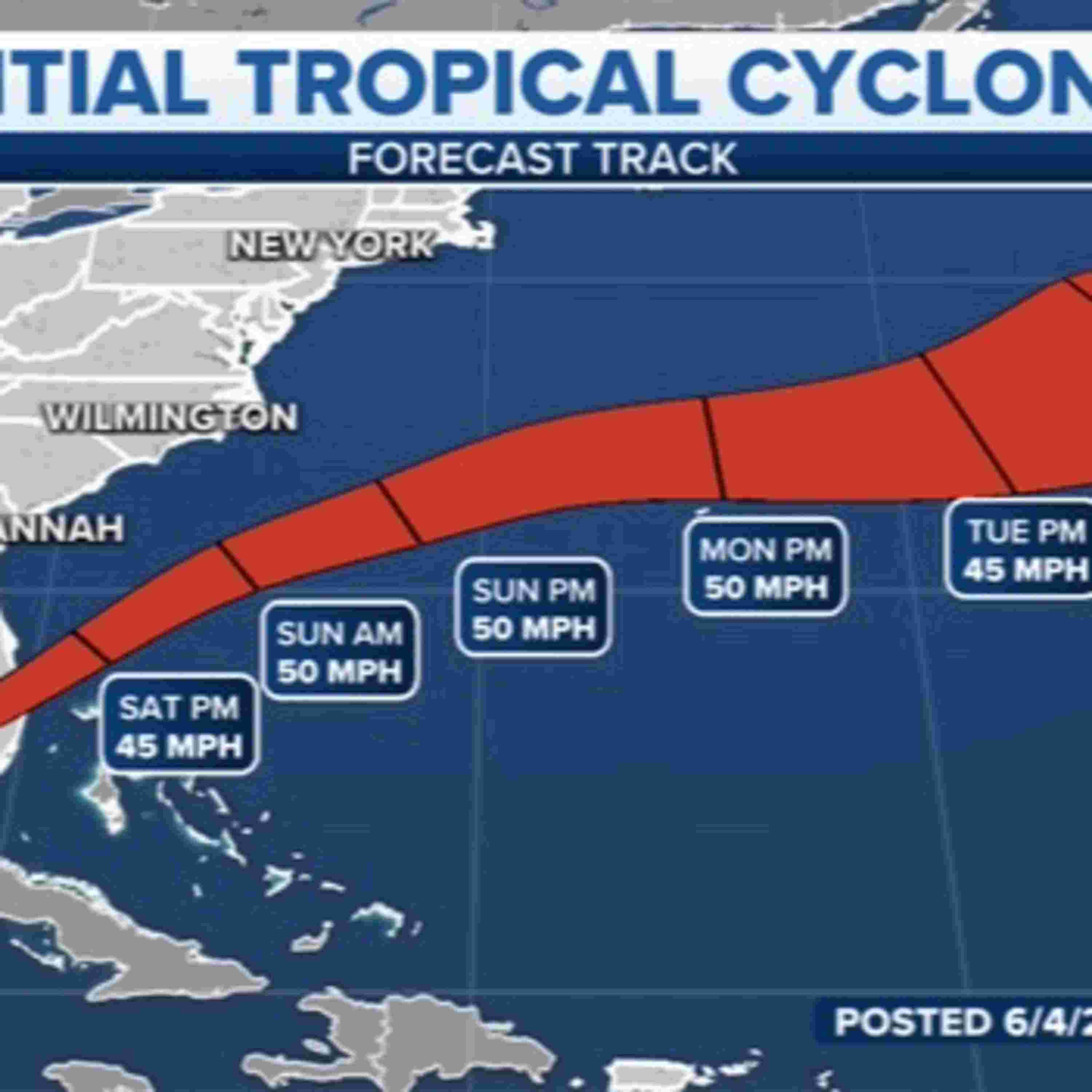
At 800 AM EDT (1200 UTC), the poorly defined center of the disturbance was located about 45 miles (70 km) south-southwest of Ft. Myers, Florida. The system is moving faster toward the northeast near 18 mph (30 km/h), and this general motion is expected to continue through tonight. A turn toward the east-northeast with an additional increase in forward speed is expected on Sunday, followed by a turn toward the east Monday night. On the forecast track, the disturbance is expected to move across southern or central Florida today, over the southwestern Atlantic north of the Bahamas tonight, and near or to the north of Bermuda on Monday.
Maximum sustained winds remain near 40 mph (65 km/h) with higher gusts, mainly in squalls. The disturbance is expected to become a tropical storm off the east coast of Florida by tonight, and some strengthening is forecast tonight through Monday as the system moves farther away from Florida over the western Atlantic. It has a high (90 percent) chance of formation during the next 48 hours and during the next five days.
Tropical-storm-force winds extend outward up to 275 miles (445 km) to the east of the center. Over the past few hours, a weather station at Government Cut near Miami, Florida reported sustained winds of 40 mph (65 km/h) and a wind gust of 53 mph (85 km/h) at an elevation of 75 ft (23 m).
RAINFALL: Heavy rainfall will affect portions of South Florida, the Keys, and the northwestern Bahamas through today. The following storm totals are expected:
South Florida: Storm total of 6 to 10 inches with isolated maxima of 15 inches. Considerable flash and urban flooding are expected.
Florida Keys: Storm total of 4 to 8 inches with isolated maxima of 10 inches. This rain may produce flash and urban flooding.
Northwestern Bahamas: Storm total of 4 to 8 inches with maxima of 12 inches. This rain may produce flash and urban flooding.
WIND: Tropical storm conditions are expected in the warning area in Florida today, especially in squalls, and in the northwestern Bahamas by this afternoon. Tropical storm conditions are still possible in western Cuba through this morning, mainly in squalls.
STORM SURGE: The combination of storm surge and the tide will cause normally dry areas near the coast to be flooded by rising waters moving inland from the shoreline. The water could reach the following heights above ground somewhere in the indicated areas if the peak surge occurs at the time of high tide...
Marco Island, FL to North Miami Beach, FL including Biscayne Bay...1-2 ft
Florida Keys and Dry Tortugas...1-2 ft
Extreme Northwestern Bahamas: Storm surge could raise water levels by as much 1- 3 ft above normal tide levels.
Surge-related flooding depends on the relative timing of the surge and the tidal cycle and can vary greatly over short distances. For information specific to your area, please see products issued by your local National Weather Service forecast office.
TORNADOES: A couple of tornadoes are possible over the southern Florida Peninsula and Upper Keys through the early afternoon.
Next complete advisory at 1100 AM EDT. www.nhc.noaa.gov